Monday, December 24, 2007

Mike and I flew across the lake yesterday. From the helicopter, we got a great view of one of the glaciers that comes into the valley! Glaciers are huge expanses of ice made from layers of snow. When more snow falls onto the top, the bottom layers of snow are smooshed into very thick ice. So the result is a big, thick hunk of ice on top of the ground. Glaciers move like very slow rivers and scrape the land below them. Over very long periods of time, they can carve out hills and lakes. Over 10,000 years ago, a lot more of Earth was covered in glaciers, because it was colder. The Great Lakes were formed by glaciers from the last ice age. Glaciers still cover a lot of land in the colder regions of Earth today, such as Antarctica. Chunks of them sometimes fall off into the ocean, making icebergs.

The glacier in the picture is Commonwealth Glacier.

Glaciers grow when it snows and rains on them. They also melt, letting out water for streams and lakes. You can see a small stream coming off towards the left in front of the Commonwealth Glacier. If a glacier melts fast, a lot of water is released. When a glacier is "retreating", that means it is melting faster than it's growing. The glacier is getting smaller, which means more land is uncovered. If you're standing on the ground, it looks like the glacier is backing up. However, that's not actually the case. It's just shrinking! Glaciers shrink very slowly, maybe an inch or so per year. But, glaciers are huge. Two inches off the entire edge of a huge glacier is still a lot of water being released!

Many scientists are concerned that, as the planet warms, glaciers will melt faster. This will release too much water into the oceans, causing ocean levels to rise. There are a lot of cities on the coasts of every country. If the water rises too much, they will be flooded! At a museum in New Zealand, I learned that the predicted change in ocean level would flood Christchurch. Only the steeple of the cathedral in their city would be above water! Melting glaciers is just one of the many reasons that people are trying to stop global warming.
On another note, check out the new arrival! My "nephew" Henry was born in Georgia while I was in New Zealand. He is almost two weeks old now. I can't wait to meet him!

Saturday, December 22, 2007

Life at the Field Camp

This is our second full day in the field. The weather is much nicer. It is just above freezing outside, and very sunny! Yesterday, it was colder, cloudy, and windy, but today will be great for field work.
There are several permanent camps around the Taylor Valley. The camps have several small cabins that are the labs for research. The bigger, round building is for cooking, eating, working, and relaxing. The buildings are solar powered and have satellite internet. So, even though we're so far away from civilization, we have electricity, phone, and email! However, there's no plumbing here, so we have no running water. We take water from the lake to cook, drink, and clean. The lake and stream water here comes from the glaciers, so is very clean and safe to drink. We bring the water to the building in buckets, filter it, and leave it in large pots until we use it.

Because this area is a desert, we have to be very careful to not use too much water, and we can't put any water back into the soil. We have to be very careful not to affect the ecosystem more than necessary. We want the Dry Valleys to be the same as when we got here and not leave any trace of human impact. We don't want to take too much water from the lake. Also, all of the water we use has to be stored and taken away with us. Since we're in a desert, the soils and living things don't get much water. If we dump all of our used water into the soil, we are giving them too much water and changing the system. We try to use very little water when cleaning and cooking, and we store all that is used. This used water is called "gray water". We even have to store the water we use to brush our teeth! We can't even take showers, because they use a lot of water. So, I haven't taken a bath for 3 days!

We also have to store all of our trash to take away with us. Our trash is taken away from Antarctica and either recycled, burned, or put into a landfill. We have to sort our trash so that this can be done properly. There are five trash cans here, each for a different type of trash. We also have to store all of the waste our bodies make. There are no bathrooms or toilets here. Everything our bodies produce (all those yucky things we don't think much about) is stored in buckets or barrels and taken away from here!

Overall, we try to be very careful not too change the Dry Valleys, which means we have to be very careful about everything we do. We eat, work, walk and sleep very carefully so that there's very little evidence that we were ever here! This way, future scientists (maybe you!) will be able to see Antarctica the same way that we're seeing right now.

Later today, our group of four researchers will split in half. Ross and Elizabeth will stay here at this camp. Mike and I will fly across the lake to a different camp. We have different projects on the other side of the lake to work on, so need to split up. This way we can get more work done during the week we'll be away from McMurdo! Mike and I will take a helicopter across the lake. That means we'll get to wear the cool helicopter helmets again!
It snowed here Thursday night! It was only a dusting, but that's a lot of snow for this area. The bad weather did not keep us from getting to the field, though (it only delayed us a few hours while the helicopters waited until they could see). So, Friday morning we flew in a helicopter across frozen water to Taylor Valley. Here is a picture of us, in all of our gear, ready to go! There's Mike, Becky, Elizabeth, and Ross, with the helicopter in the background.

We landed at Lake Fryxell, and set ourselves up at the camp. There are small buildings here for eating and working in, but we sleep in tents outside. We are staying at this camp with four people from NASA. They are working on the Phoenix Project, which is a machine that was sent to Mars to look at Martian soil. They are comparing the dry, cold soil here on Antarctica to the dry, cold soils on Mars. This is one of the NASA scientists, Doug, acting silly after a day of hard work!After settling in, we started our field work. We hiked up one of the slopes in the Valley, taking soil samples every 10 meters. This way, we can compare different types of soil with elevation. Long ago, the water in the lake was higher, and there were glaciers covering the whole area. This means that the soil changes as you go higher up a slope. Different soil types will then also change what can live in the soil. We're also interested in what lives in the soil, we also spent some time looking for mosses and measuring how much the animals living in the soil breathe.
We have a neat machine that can measure that for us, by measuring carbon dioxide (the gas that's released when you breathe) in a small area of the soil.

The computer is almost out of battery, so I'll need to write more later!

Thursday, December 20, 2007

So far, we've been at our "home base" of McMurdo Station, which is on Ross Island. So, right now, we're technically not sitting on the continent of Antarctica. We're on an island very close to Antarctica in the ice shelf (which would be water, if it weren't covered with a glacier). Tomorrow we'll take a helicopter from McMurdo to the mainland of Antarctica to begin our field work. The particular area where we work is called the Dry Valleys. These valleys are in the Trans-Antarctic Mountains. This big chain of mountains runs from one end of Antarctica to the other. It is made up of smaller ranges, such as the Asgard Mountains and Royal Society Mountains. This is similar to how the Appalachian Mountains run from Georgia into Canada, but are made up of smaller ranges like the Green Mountains and White Mountains, or the Tetons in the Rocky Mountains. The smaller ranges of the Trans-Antarctic Mountains run next to each other, with valleys in between them. These valleys are the Dry Valleys. Here's what that looks like in a close-up map (upside-down from the one above):
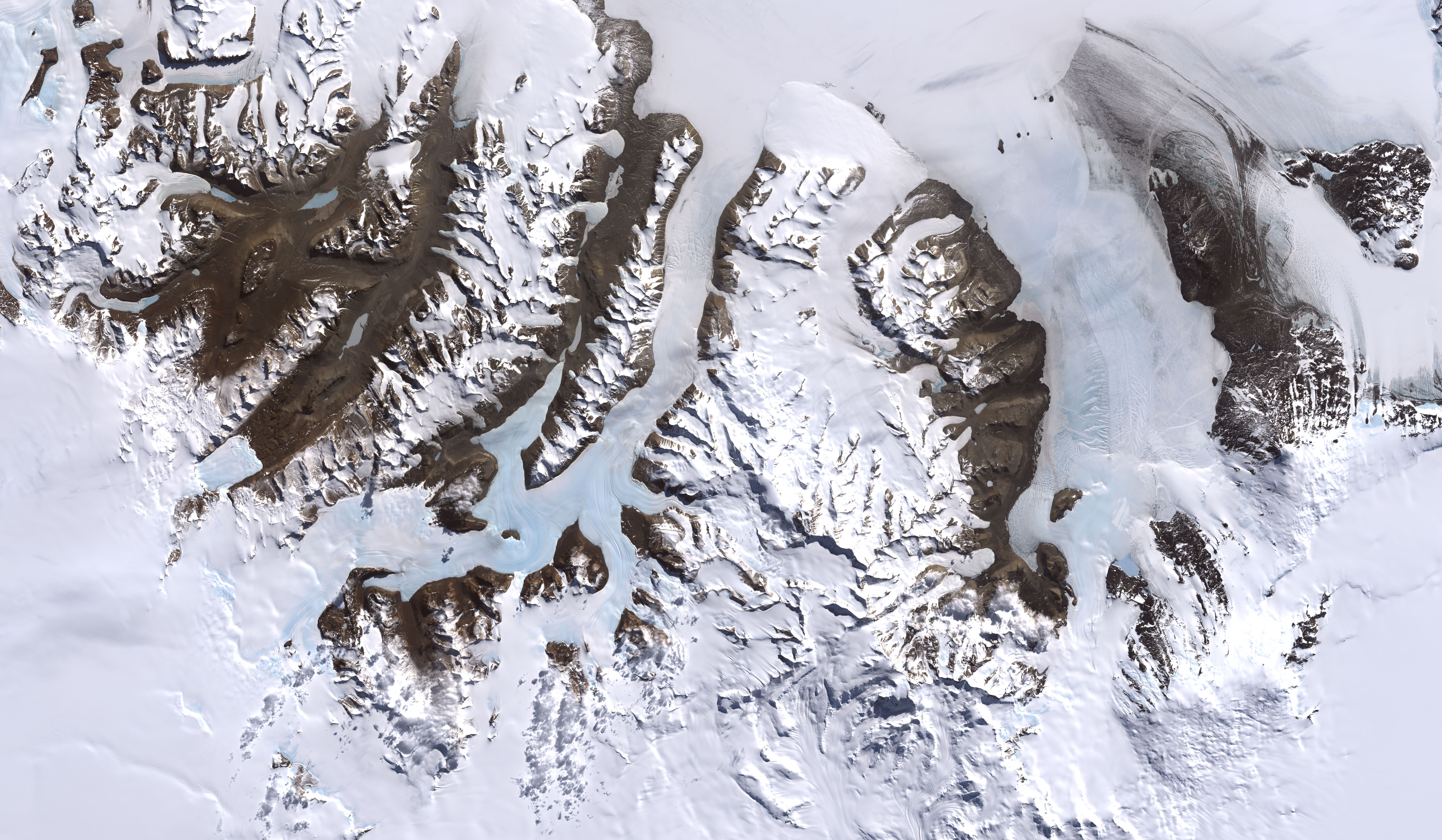
And here's what that looks like from a satellite (rotated 90 degrees from map above):
This picture shows where each of those ranges meets the sea. You see the mountains running alongside each other, with flat parts in between them. Those flat points are the valleys, some of which are covered with glaciers. The Dry Valleys are the valleys without glaciers, and they form the largest ice-free area on Antarctica. They receive very little snowfall, and never any rain. Instead of being covered with ice and snow, they are covered with loose rocks and soil. It's the soil that we're interested in! We do most of our work in Taylor Valley, which has 3 lakes (that are frozen, of course). Tomorrow, we'll be going to one of those lakes, called Lake Fryxell. Soon, I'll be able to show you actual photographs of our research group at Lake Fryxell in Taylor Valley!

The Dry Valleys are deserts, just like we have in the U.S. Most deserts are very hot, but the deserts on Antarctica are very cold! This is called a polar desert. So far the weather has been fairly nice, without being too cold. But, the weather is predicted to change before tomorrow, and will become cloudy with a chance of snow!

Wednesday, December 19, 2007

Snow School

Yesterday I went to Snow School. This is a camping trip where we learn survival skills to help us when we're out in the field. Antarctica is very windy and it's hard to predict when a storm might come, so we always have to be prepared to be caught in bad weather.

Our group was driven out to the McMurdo Ice Shelf. This is an incredibly thick piece of floating ice, several hundred meters thick, that forms where the glacier breaks off from land and flows into the sea. An ice shelf is different from sea ice, because sea ice is made of frozen seawater and melts when the temperature warms, but ice sheets are permanent because they are made of glaciers (so not salty). In the picture below, the mountains are on land. The jagged edges of the mountains show where the glacier breaks, and the flat ice is the McMurdo Ice Shelf, where we were camping.
On Antarctica, roads are marked by flags. Green and red flags show where it is safe to travel, and black flags show where there is danger (but only the danger that has been mapped! There are many dangerous areas that are not flagged). The flags in the picture above show a road on the McMurdo Ice Sheet leading to the airport. No pavement, yellow lines, or street signs here!

We were driven out on these roads by huge trucks called Delta's. The Delta's big tires can safely cross the traverse from land to ice and prevents it from falling into cracks.

At our camping site, we built our own structures to sleep in. First, we put up a special type of tent called Scott Tents, which are tall and pyramid-shaped. These are especially designed to withstand high winds (up to 80 mph). This is necessary, since Antarctica is the windiest of all the continents. We didn't want our whole camp to be blown away and be left homeless all night! So, we built a wall of snow connecting the Scott Tents. We did this by cutting squares of snow from the top of the ice shelf and stacking them into a wall (just like you do with Legos!). The Scott Tents, connected by the snow wall, will help protect the rest of the camp from the wind.

Inside the wall, we also put up regular dome tents, like what you and your family may use when you go camping. However, it's hard to anchor tents to the ground in soft snow, so we had to dig trenches into the ground to bury our tent stakes (these buried anchors are called "dead men").
We also learned to build structures out of snow, in case we get stuck out in the weather with no camping gear. We built a snow cave by piling up all of our duffle bags, then covering them in snow. The snow gets packed down with shovels, then left to sit in the sun and refreeze. After a while, you dig a tunnel to pull out all of the bags, and an open cave remains. It's sort of like an igloo, but messier.We also dug snow trenches that you can sleep inside of. They are small (just the size of one person) and not very warm, but protected from the wind.

Overall, the first day of snow school involved a whole lot of shoveling and sawing! We camped out that evening in the structures we built, and were able to stay very warm even though the temperature outside was only about 20 degrees Fahrenheit. We spent the next day (today) learning other useful survival skills, like how to set up portable VHF radios. We were able to call and talk to people at the South Pole with those radios! We also pretended to be caught in a white-out (when it's snowing so hard you can't see or hear) by placing buckets over our heads. With our heads covered, we had to try to locate one of our team members who was pretending to be lost in the snow.

Tomorrow is our last day to prepare ourselves for our field work. Friday morning we'll leave for Taylor Valley, where we will spend the next week collecting samples for our research!

Monday, December 17, 2007

Here are some pictures from the area around McMurdo:In the background you see Mt. Erebus , the most active volcano on Antarctica. You can see the steam coming out of the top. However, the lava is not very thick, so it is not likely to clog and cause an eruption.

A seal warms itself in the sun on the ice covering the Ross Sea. Since the temperature hasn't been very cold, the ice is starting to melt. This happens every summer when the temperatures get warmer. Just imagine a summer where the temperature is just barely above freezing! The roads that cross the ice have been closed, since the ice is no longer thick enough to carry the weight of a truck or airplane.

These shacks get pulled onto the ice, so that the scientists studying the sea underneath can stay warm.

Saturday, December 15, 2007

On the Ice

We have arrived on Antarctica!

Friday morning we left New Zealand on a US Air Force C-17 airplane (crewed by the awesome 62d Airlift Wing from McChord Air Force Base). In the picture on the left, Ross is stretching his legs during the 5 hour flight.

We were allowed to come into the cockpit during the flight, which gave us a great view of the ocean, sea ice, and the Antarctic continent as we approached.

After we landed, we traveled to our new home: McMurdo Station. We have spent the past day and a half setting up our lab and preparing for our field work. We have machines to set up, supplies to collectto wash, chemical solutions to make, and camping gear to collect before we can begin our research.


So far the weather has been great! It is slightly below freezing (about 30 degrees Fahrenheit) but overall much warmer than Dartmouth was when we left! Since we're in the Antarctic circle, the sun never sets and there are 24 hours of daylight. The earth is tilted, so as the Earth revolves around the sun (which takes one year), certain parts of the Earth are closer to the sun at different times of the year. This is why we get different seasons of warm and cold temperatures during the year. Right now, the southern hemisphere is closer to the sun than the northern hemisphere. That makes it summer here, but winter for the northern hemisphere. Antarctica is at the tip of the southern hemisphere, so always facing the sun during this time of the year. In six months, the Earth will be on the other side of the sun and it will be winter on Antarctica, with 24 hours of darkness (which it will be summer for us in the US!).

Below are a couple of pictures from areas nearby our base. Elizabeth is walking around a pond. She's the small red dot on the other side of the pond. She was very excited, because she found some algae and bacteria growing on the rocks alongside the stream! The ball in the mountain behind her houses a very large satellite dish that tracks the US space shuttles. In the second picture, I am squatting in front of the Ross Sea (which is frozen). On the far side of the Ross Sea is the Royal Society Range of the Trans-Antarctic Mountains. We will be doing most of our research in the valleys of this mountain range. The mountains appear fairly close, but they are actually about 60-70 miles or so away from me. That means it would take an entire hour for me to drive across if I could go as fast as a car on the highway in the U.S. Since there are very few people or man-made objects here, there aren't very many things to help you judge the size and distance of things.